The USGS National Geospatial Program manages the National Hydrography Dataset (NHD), Watershed Boundary Dataset (WBD), and NHDPlus High Resolution (NHDPlus HR). These geospatial datasets represent the surface water of the United States for mapping and modeling applications.
Note: Users should be aware that temporal changes may have occurred since this data set was collected and that some parts of this data may no longer represent actual surface conditions. Users should not use this data for critical applications without a full awareness of its limitations. No liability for data content or accuracy is presumed by USGS.
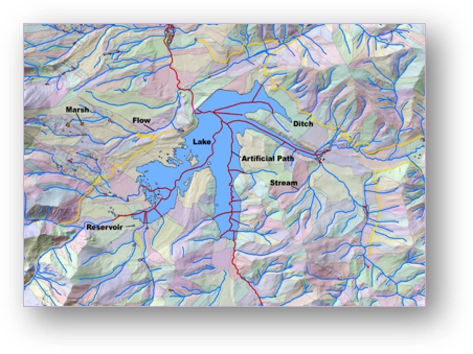
National Hydrography Dataset (NHD)
Complementing The National Map (TNM), NHD is the surface water component that provides data on features such as lakes, ponds, streams, rivers, canals, dams and stream gages. These data are designed to be used in general mapping and in the analysis of surface water systems. For more information click here.
Watershed Boundary Dataset (WBD)
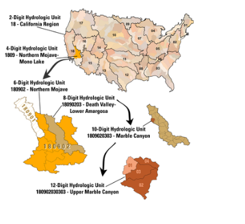
The WBD defines the areal extent of surface water drainage to a point, accounting for all land and surface areas of the country in eight nested levels delineated by Hydrologic Unit Codes (HUC). For more information click here.
National Hydrography Dataset Plus High Resolution (NHDPlus HR)
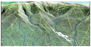
The NHDPlus HR is a scalable geospatial hydrography framework built from the high resolution National Hydrography Dataset, nationally complete Watershed Boundary Dataset, and ⅓ arc-second 3D Elevation Program data. The NHDPlus HR brings modeling and assessment down to a local, neighborhood level, while nesting seamlessly into the national context. For more information click here.