and click the desired base
map. To close base map panel, click the base map button again.
and click the desired base
map. To close base map panel, click the base map button again.HydroAdd has a variety of base maps to choose from. To change the base map, click the base map button and click the desired base
map. To close base map panel, click the base map button again.
Available base maps include:
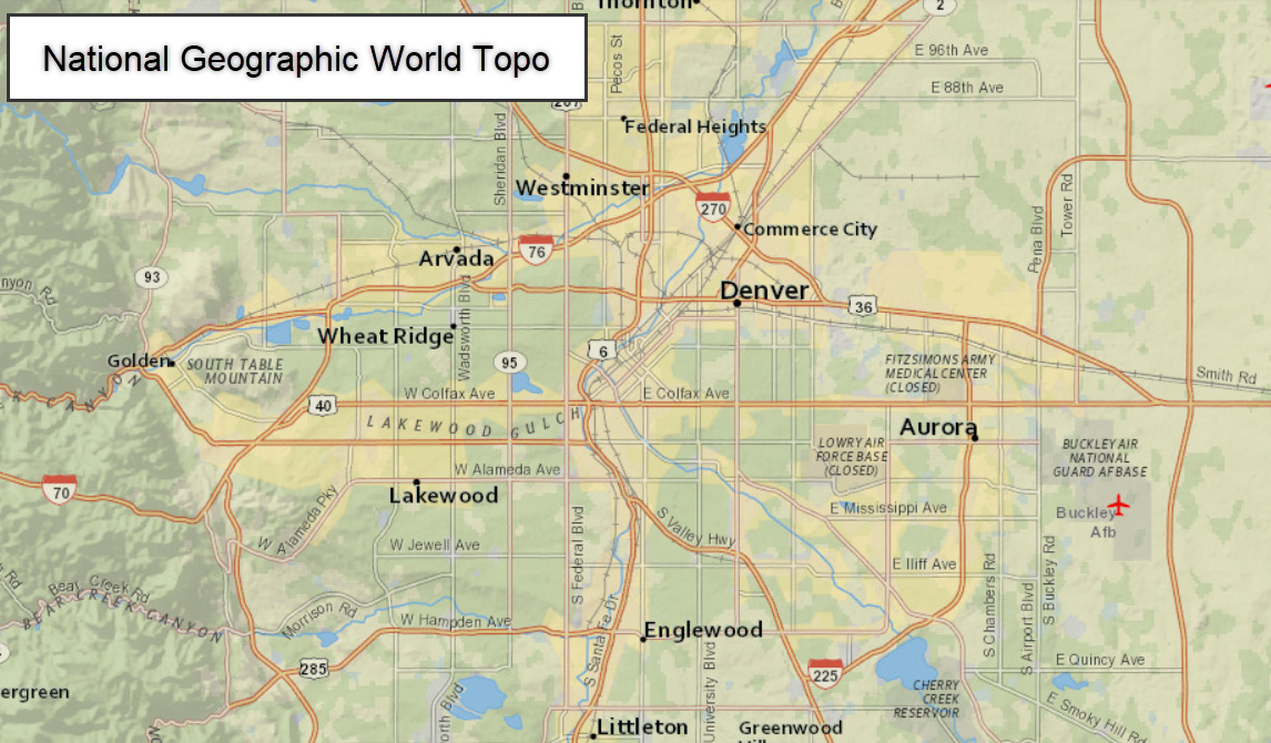
The National Geographic World Map was developed by National Geographic and Esri and reflects the distinctive National Geographic cartographic style in a multi-scale reference map of the world. From the Esri Living Atlas:
https://www.arcgis.com/home/item.html?id=b9b1b422198944fbbd5250b3241691b6
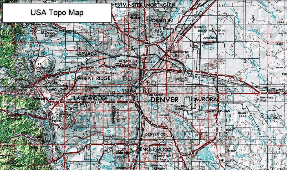
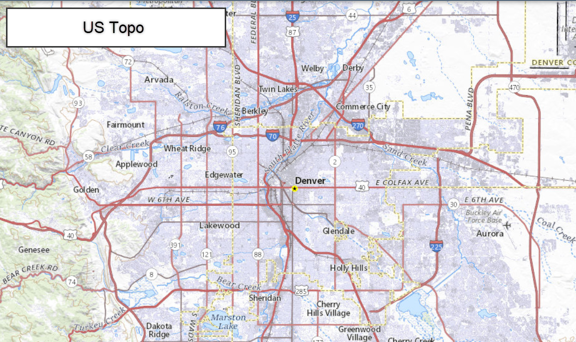
The USA Topo Maps presents land cover and detailed topographic maps for the United States. The map includes the National Park Service (NPS) Natural Earth physical map at 1.24km per pixel for the world at small scales, i-cubed eTOPO 1:250,000-scale maps for the contiguous United States at medium scales, and National Geographic TOPO! 1:100,000 and 1:24,000-scale maps (1:250,000 and 1:63,000 in Alaska) for the United States at large scales. The TOPO! maps are seamless, scanned images of United States Geological Survey (USGS) paper topographic maps.
From Esri Living Atlas: https://usgs.maps.arcgis.com/home/item.html?id=931d892ac7a843d7ba29d085e0433465
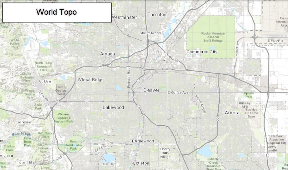
The Esri World Topo is compiled from a variety of authoritative sources from several data providers, including the U.S. Geological Survey (USGS), U.S. Environmental Protection Agency (EPA), U.S. National Park Service (NPS), Food and Agriculture Organization of the United Nations (FAO), Department of Natural Resources Canada (NRCAN), HERE, and Esri. Data for select areas is sourced from OpenStreetMap contributors. Specific country list and documentation of Esri's process for including OSM data is available to view . Additionally, data for the World Topographic Map is provided by the GIS community. You can contribute your data via the Community Maps Program and have it served by Esri. View the list of Contributors for the World Topographic Map .
https://usgs.maps.arcgis.com/home/item.html?id=f7a8b4dca5c44bd3a52c3fb8922a51fc
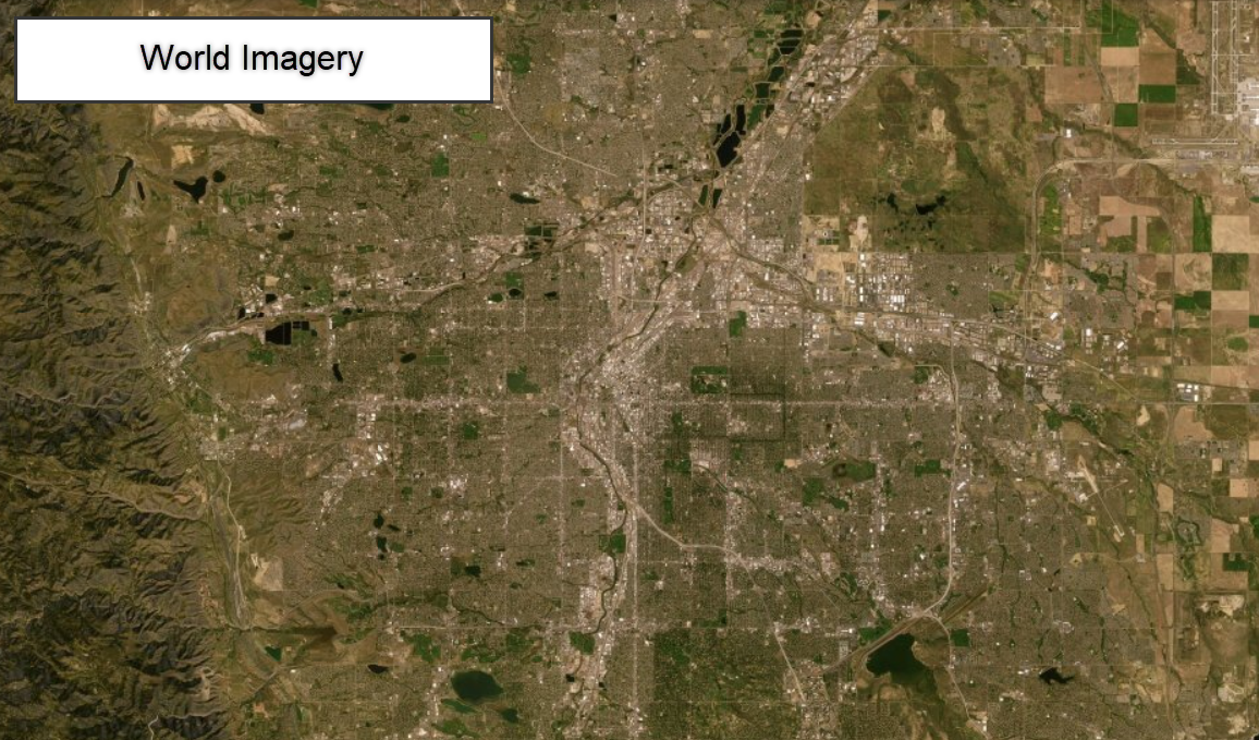
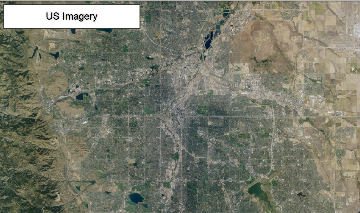
The Esri World Imagery provides one meter or better satellite and aerial imagery in many parts of the world and lower resolution satellite imagery worldwide. The map includes 15m TerraColor imagery at small and mid-scales (~1:591M down to ~1:72k) and 2.5m SPOT Imagery (~1:288k to ~1:72k) for the world. The map features 0.5m resolution imagery in the continental United States and parts of Western Europe from Maxar. Additional Maxar sub-meter imagery is featured in many parts of the world. In other parts of the world, imagery at different resolutions has been contributed by the GIS User Community. In select communities, very high-resolution imagery (down to 0.03m) is available down to ~1:280 scale. You can contribute your imagery to this map and have it served by Esri via the Community Maps Program. View the list of Contributors for the World Imagery Map.
https://usgs.maps.arcgis.com/home/item.html?id=10df2279f9684e4a9f6a7f08febac2a9
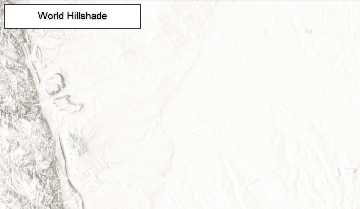
The Esri World Hillshade portrays elevation as an artistic hillshade. The map is designed to be used as a backdrop for topographical, soil, hydro, landcover or other outdoor recreational maps. The map was compiled from a variety of sources from several data providers. The basemap has global coverage down to a scale of ~1:72k. In the United States, Western Europe, Finland, and Norway coverage is provided to ~1:18k. Additionally, Netherlands, Denmark, Finland and select areas of the U.S. are provided down to ~1:9k.
https://usgs.maps.arcgis.com/home/item.html?id=f47a5a35be8c41f7890c1763f65a6d9f
The USGS Topo is a tile cache base map service that combines the most current data in The National Map (TNM), and other public-domain data, into a multi-scale topographic reference map. Data themes included are Boundaries, Geographic Names, Transportation, Contours, Hydrography, Land Cover, Shaded Relief, and Bathymetry. This service is designed to provide a seamless view of TNM data in a geographic information system (GIS) accessible format.
https://basemap.nationalmap.gov/arcgis/rest/services/USGSTopo/MapServer
The USGS Imagery Only is a tile cache base map service of orthoimagery in The National Map visible to the 1:9,027 zoom scale. Orthoimagery data typically are high resolution aerial images that combine the visual attributes of an aerial photograph with the spatial accuracy and reliability of a planimetric map. USGS digital orthoimage resolution may vary from 6 inches to 1 meter. In the former resolution, every pixel in an orthoimage covers a six-inch square of the earth's surface, while in the latter resolution, one meter square is represented by each pixel. Blue Marble: Next Generation and Landsat imagery data sources are displayed at small to medium scales, however, the majority of the imagery service source is from the National Agriculture Imagery Program (NAIP) for the conterminous United States. The data is 1 meter pixel resolution collected with "leaf-on" conditions. Collection of NAIP imagery is administered by the U.S. Department of Agriculture's Farm Service Agency (FSA). In areas where NAIP data is not available, other imagery may be acquired through partnerships by the USGS. For Alaska, 10-meter resolution SPOT imagery is provided for viewing. The National Map download client allows free downloads of public domain, 1-meter resolution orthoimagery in JPEG 2000 (jp2) format for the conterminous United States, including some locations at 1-foot (or better) resolution also in JPEG 2000 (jp2) format. However, the 10-meter Alaska orthoimagery data will not be available for direct download from the National Map due to license restrictions. For additional information on orthoimagery, go to https://nationalmap.gov/ortho.html
https://basemap.nationalmap.gov/arcgis/rest/services/USGSImageryOnly/MapServer
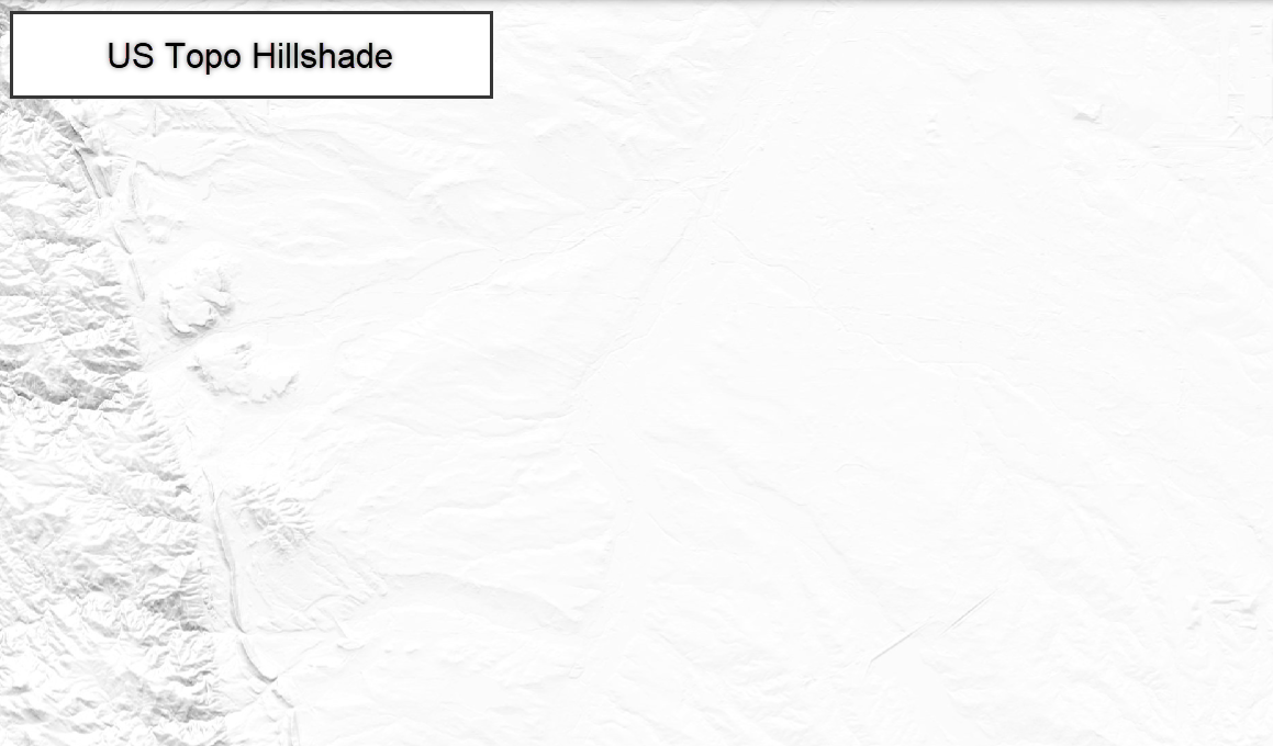
The USGS US Topo Hillshade base map service from The National Map was created with data from the 3D Elevation Program (3DEP) for large and medium scales (1:9,028 through 1:1,155,581), and Global Multi-resolution Terrain Elevation Data 2010 (GMTED2010) for small scales (1:2,311,162 through 1:295,828,764). 3DEP maintains a seamless dataset of best available raster elevation data, as LIDAR and as digital elevation models (DEMs), for the conterminous United States, Alaska, Hawaii, and Territorial Islands. Resolutions available include 1-meter, 3-meter (1/9-arc-second), 10-meter (1/3-arc-second), 30-meter (1-arc-second), and 60-meter (2-arc-second; only in Alaska). 3DEP also contains coverage of Canada, Mexico, Central America, and the Caribbean at 30-meter (1-arc-second) resolution. 3DEP shaded relief was derived with a multi-directional hillshade technique. Small-scale shaded relief was created with a single-direction hillshade from GMTED2010 global elevation data at 7.5-, 15-, and 30-arc-second resolutions, and resampled further for scales 1:18,489,298 and smaller. Ocean areas are left unfilled for maximum flexibility by end users. For additional information, go to https://www.usgs.gov/core-science-systems/ngp/3dep, https://www.usgs.gov/core-science-systems/eros/coastal-changes-and-impacts, and https://apps.nationalmap.gov/3depdem/.
https://basemap.nationalmap.gov/arcgis/rest/services/USGSShadedReliefOnly/MapServer
The Hillshade turns off at zoom level 16.
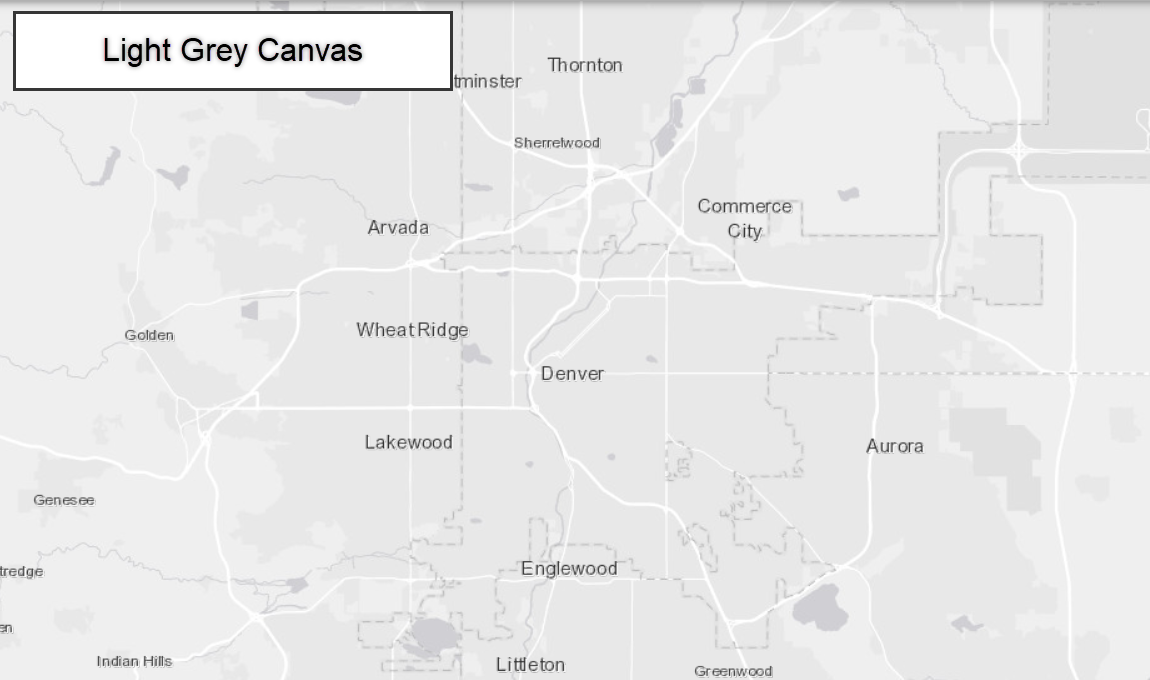
This web map provides a detailed vector basemap for the world symbolized with a light gray, neutral background style with minimal colors, labels, and features that is designed to draw attention to your thematic content.
https://usgs.maps.arcgis.com/home/item.html?id=979c6cc89af9449cbeb5342a439c6a76
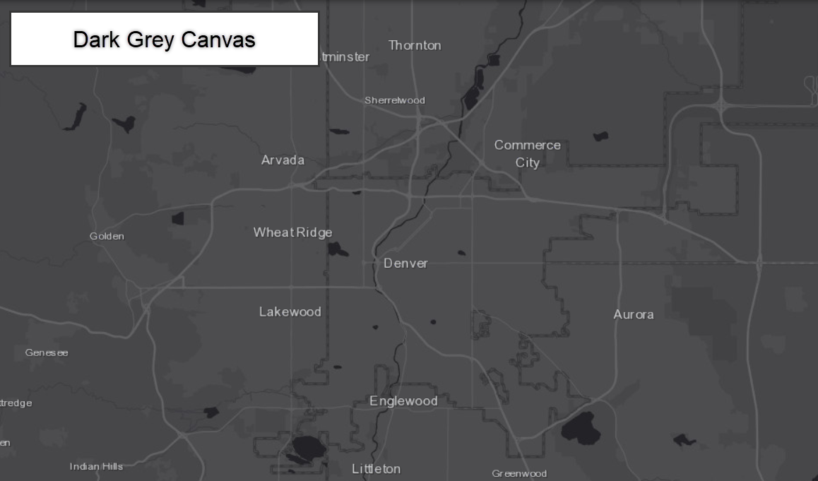
This web map provides a detailed vector basemap for the world symbolized with a dark gray, neutral background style with minimal colors, labels, and features that is designed to draw attention to your thematic content.
https://usgs.maps.arcgis.com/home/item.html?id=358ec1e175ea41c3bf5c68f0da11ae2b
No base map.