Editing Lines
HydroAdd lines are always “single reach” (also known as “single route”). HydroAdd cannot draw “multi-reach” (also known as “multi route”) lines.
- This means that any lines you draw with HydroAdd cannot be longer than a ReachCode.
- You can draw multiple and/or overlapping lines on a single ReachCode, but the lines geometry cannot extent beyond either end of the ReachCode.
- If you draw a line that has start and end points on different ReachCodes, HydroAdd automatically cuts the line at the ReachCodes, creating one line for each ReachCode.
Option to use full reach
When “Use Full Reach” is on (default is on), you can make a line that spans the entire ReachCode with just one click. The new line spans the entire ReachCode, from measure 0 to measure 100. The measure is always a number between 0 and 100. In the NHD
HR model, the From Measure is always upstream--the larger measure, while the To Measure is always downstream--the smaller measure. Measure can be thought of as a "percent upstream" on a ReachCode. Use Full Reach is on by default.
Use Full Reach is a convenient way to move a line to a different ReachCode.
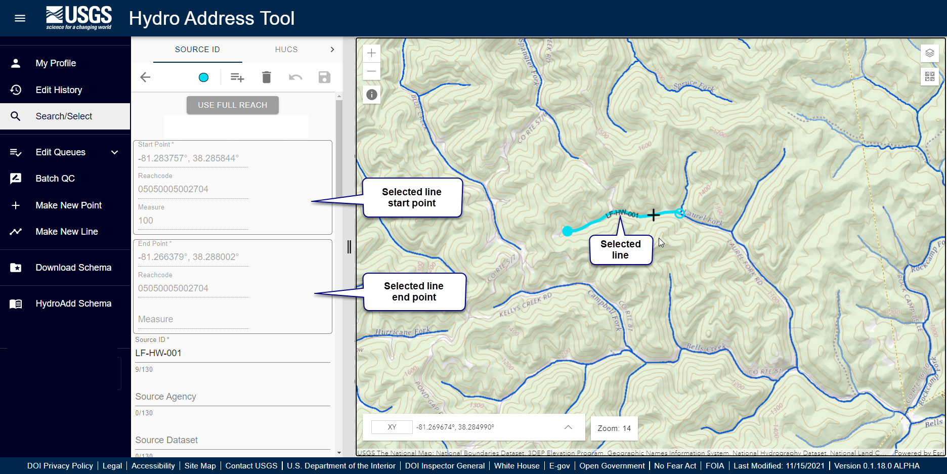
- Open a line feature for editing.
- The selected line appears in the map in cyan.
- At zoom level 14 or greater, the editing crosshair cursor appears in the map.
- The editing pane appears, showing the HydroAdd line schema.
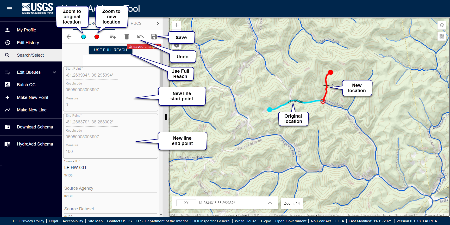
- Turn on “Use Full Reach” button.
- Click once on a ReachCode.
- After a moment, the updated line appears in red, spanning the ReachCode from measure 0 to measure 100.
- Update the SourceID, SourceDataset, SourceFeatureURL, and FeatureType.
- SourceID cannot be Null. If SourceID is Null, the item cannot be saved.
- Click the save icon in the upper right side of the editing pane.
Learn more about editing at Editing Overview.
Option to use partial reach
When “Use Full Reach” is off, you must click both the start and end points of the new line. The measure is always a number between 0 and 100-- downstream 0 and 100 being upstream. In the NHD HR model, the From Measure is always upstream--the larger
measure, while the To Measure is always downstream--the smaller measure. Measure can be thought of as a "percent upstream" on a ReachCode.
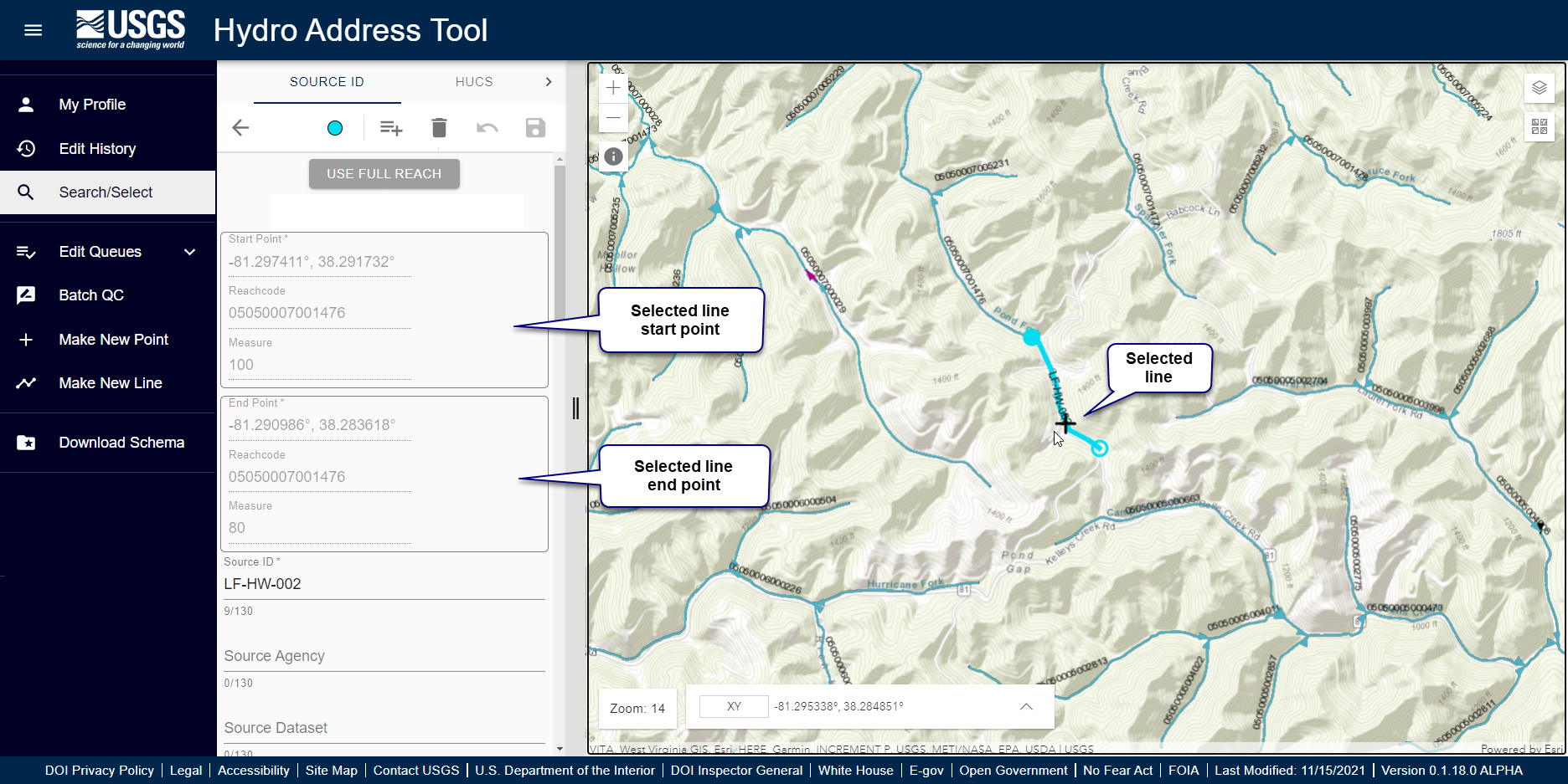
- Open a line feature for editing.
- The selected line appears in the map in cyan.
- At zoom level 14 or greater, the editing crosshair cursor appears in the map.
- The editing pane appears, showing the HydroAdd line schema.
- Turn off “Use Full Reach” button
- Click once to make the new start point of the line.
- A red halo appears at the new start point location.
- HydroAdd updates the ReachCode, FromMeasure, FromSnapDistance, ToSnapDistance, GNIS_NAME, GNIS_ID, and other QC fields.
- Click a second time to make the new end point of the line.
- If the end point is on a different ReachCode than the start point, HydroAdd creates multiple lines—one line for each ReachCode.
- Different ReachCodes are indicated by points
- Adjust the line by clicking again. You can adjust the line as many times as necessary. The line is not final until you save.
- Consecutive clicks cycle through the start and end points. For example:
- First click makes the start point of the line.
- Second click makes the end point of the line
- Third click makes a new start point.
- Fourth click makes a new end point.
- Fifth click makes a new start point, and so on…
- After a moment, the updated line(s) appears in red.
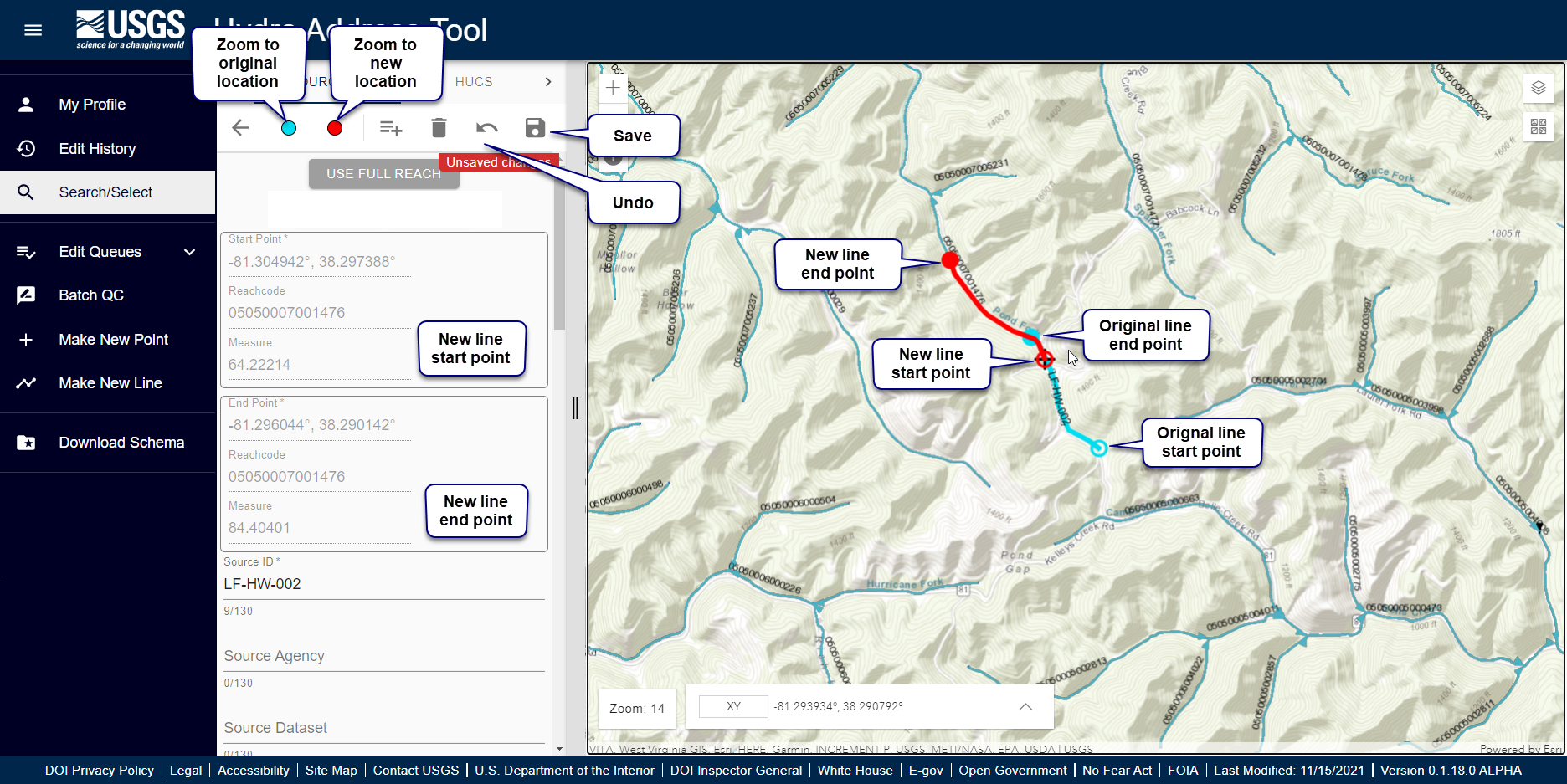
- If the end point is on a different ReachCode than the start point, HydroAdd creates multiple lines—one line for each ReachCode.
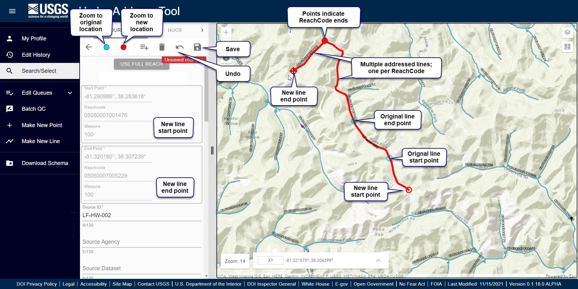
- Update the SourceID, SourceDataset, SourceFeatureURL, and FeatureType.
- SourceID cannot be Null. If SourceID is Null, the item cannot be saved.
- If there are multiple lines, each line has will have the same SourceID—and if you entered them—SourceDataset, SourceFeatureURL and FeatureType.
- Click the save icon in the upper right side of the editing pane.
- Confirmation popup indicates feature created.
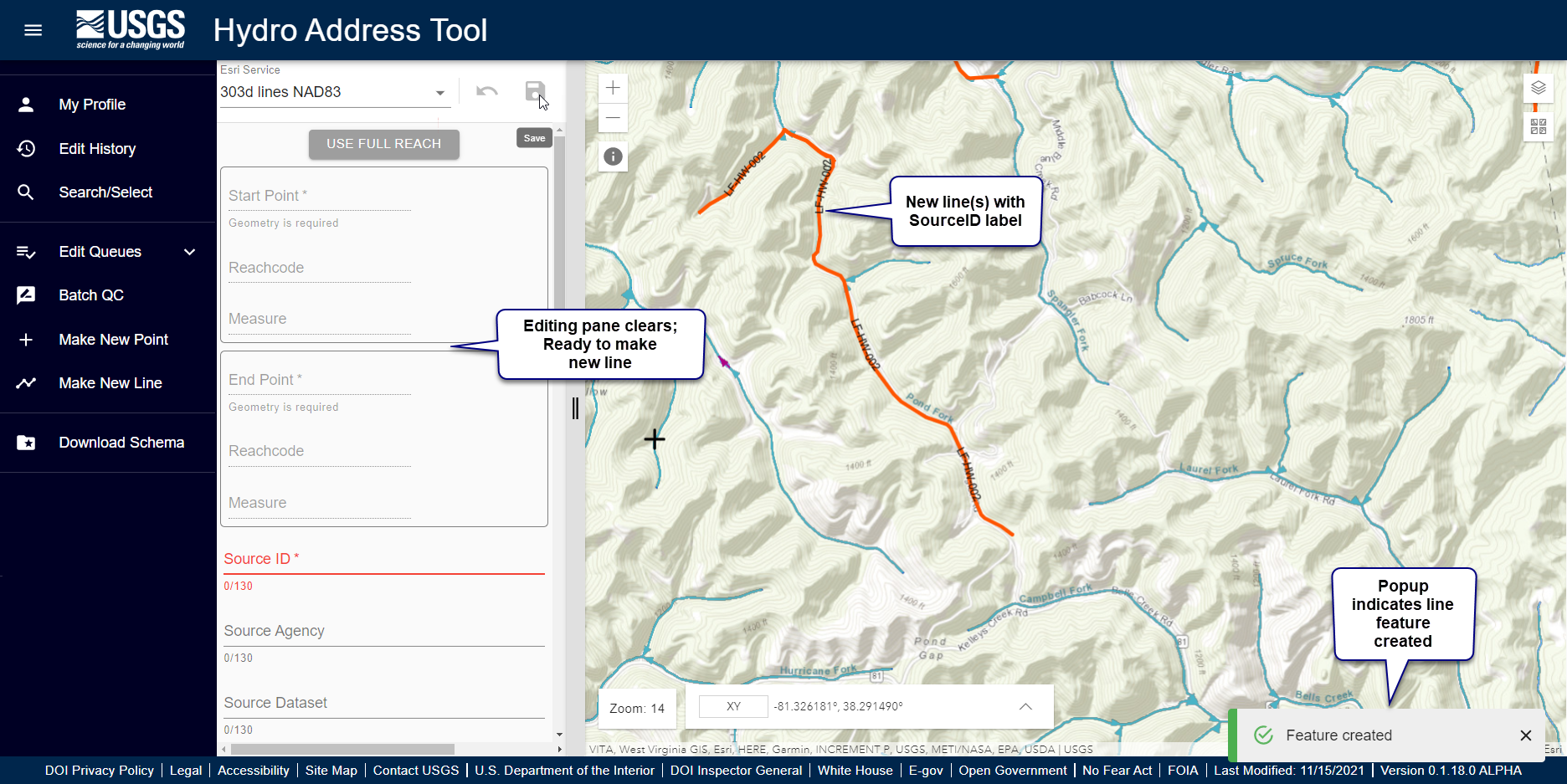
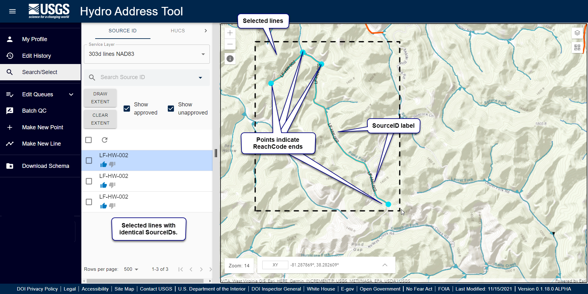
- You can confirm creation of multiple line events by selecting the new lines.
- If there are multiple lines, each line has the same SourceID—and if you entered them—SourceDataset, SourceFeatureURL and FeatureType.
- Ends of ReachCodes are indicated with opaque points.
Learn more about editing at Editing Overview.