
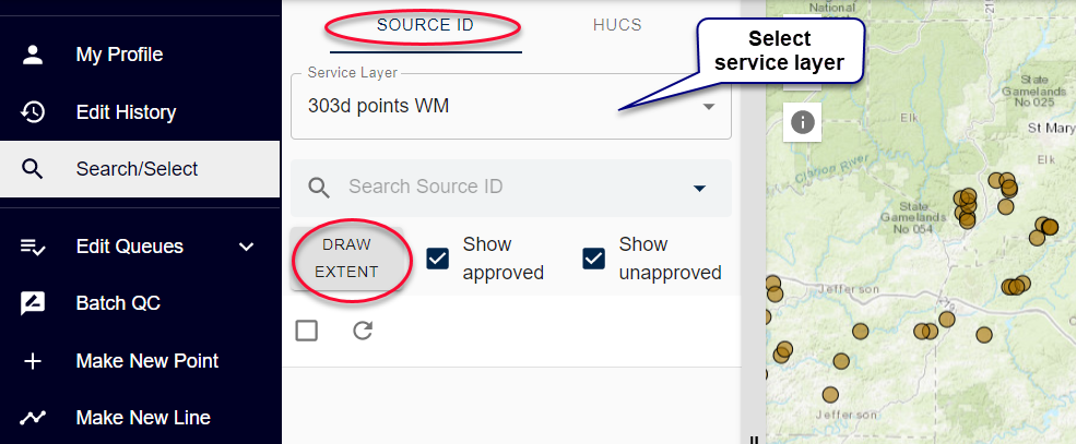
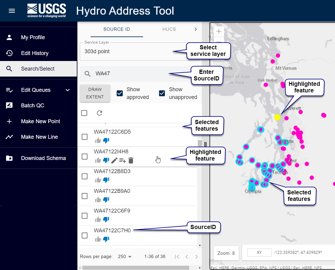
You can search your service layer to make a selection. A selection is a temporary list of features in your service layer. To make a selection permanent, add it to a queue. Features in the selection appear as rows in the selection pane.
There are three ways you can select items from your service layer:
NOTE: To make a selection permanent, add it to a queue.
To make a selection by drawing an extent:
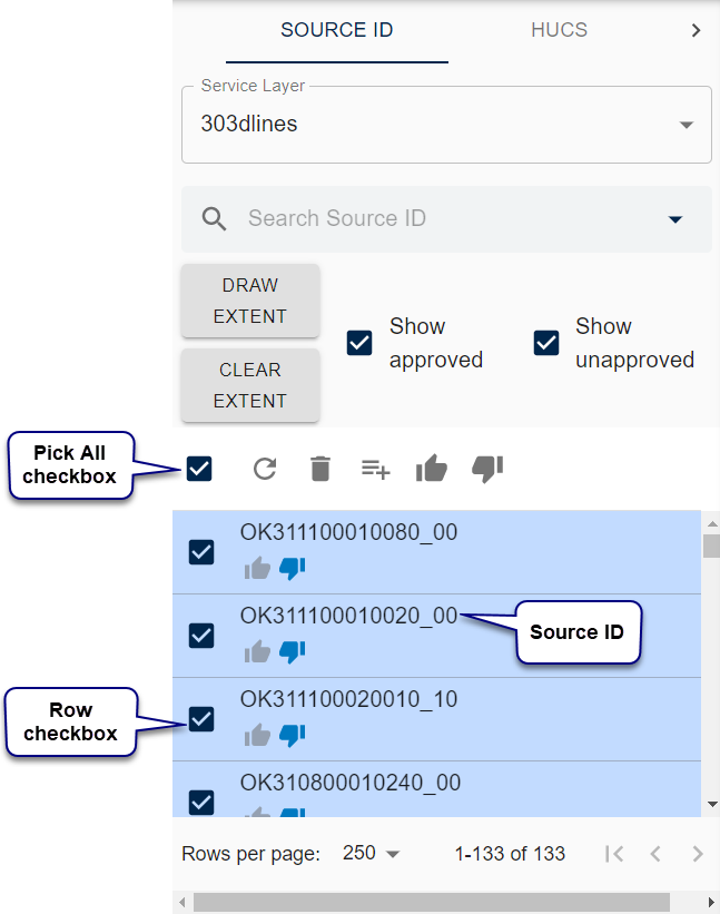
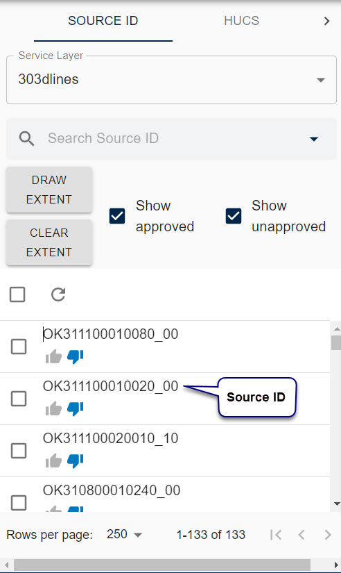
Enter a SourceID to filter the selection.
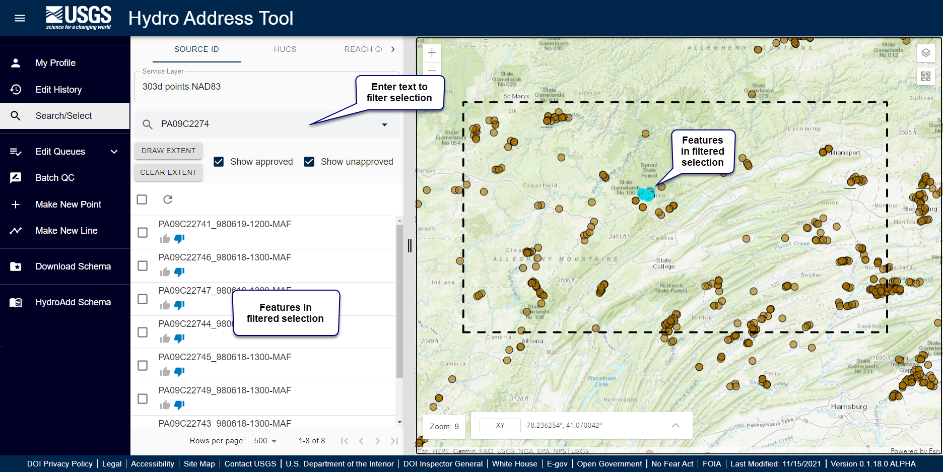
Search a service layer by SourceID:
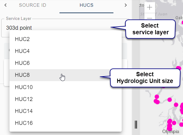
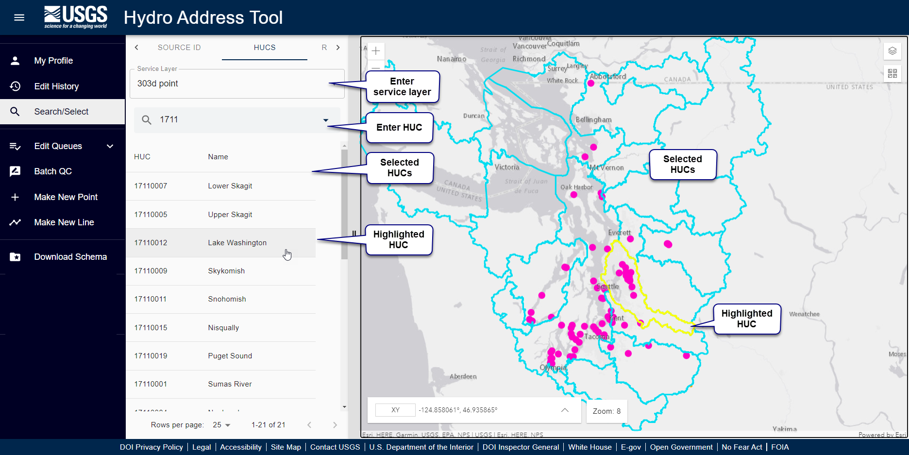
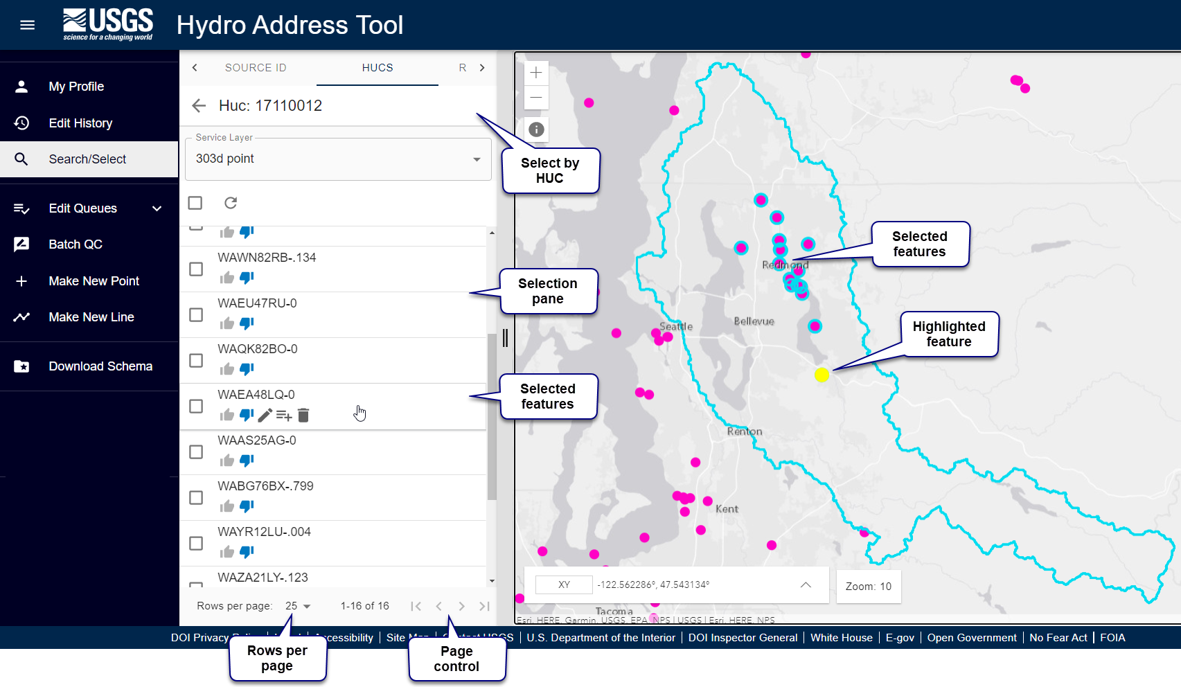
To select features by Hydrologic Units:
Search by ReachCode does not search your service layer. Rather, HydroAdd searches for ReachCodes in the National Map NHD HR service layer. This function is a convenient way to find ReachCodes.
NOTE: you cannot make a selection from your service layer with ReachCodes. There are very many ReachCodes in the NHD, so this search can take a few minutes.
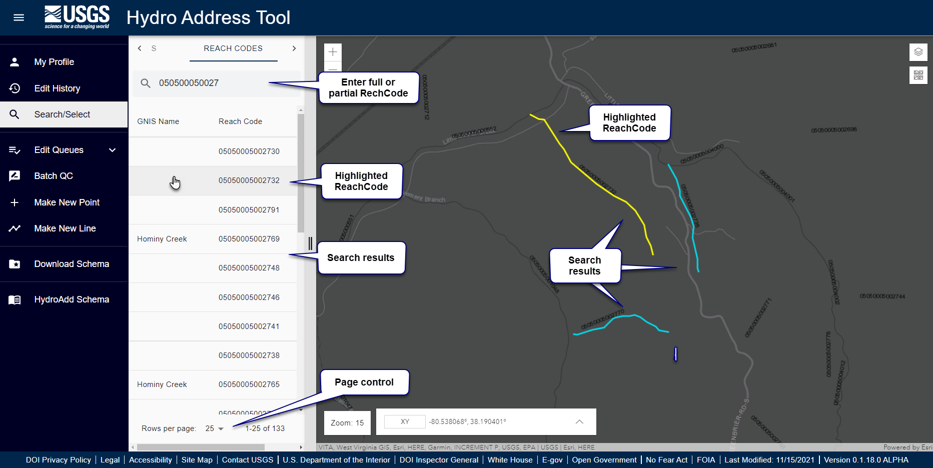
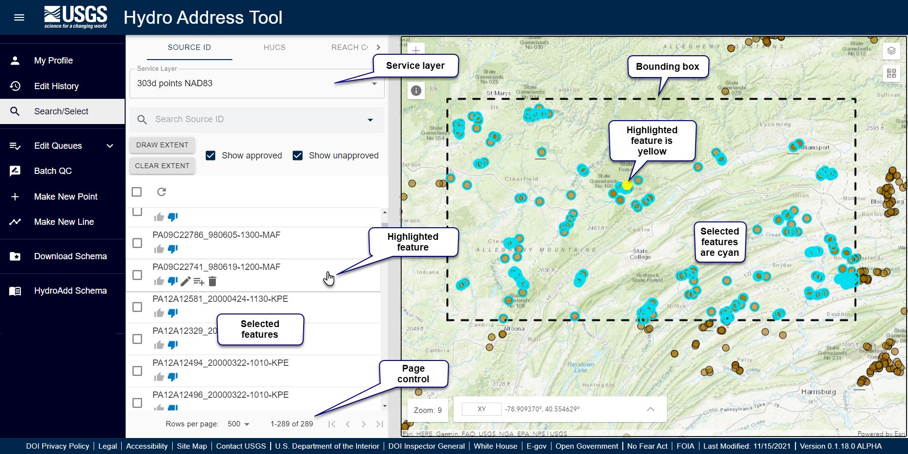
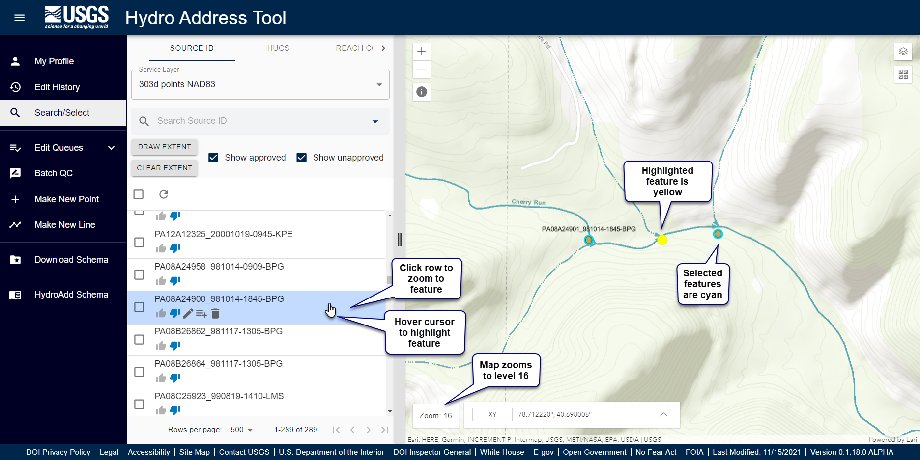
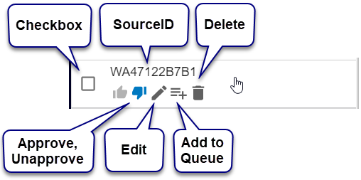
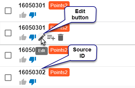
Click the row to zoom to the feature. Hover the cursor over a row to access the row buttons. Each row has four buttons: Approve, Unapprove, Edit, Add to Queue, and Delete.
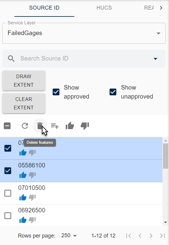
Use the Pick All checkbox to pick all rows on a page or use the checkbox in a row to pick single features. Note that the Pick All checkbox only picks rows displayed on a page. For example, if there are 10 rows in the Search/Select pane, only 10 features will be picked. To pick more rows, increase the number of rows per page or go to the next page. Once you have picked multiple rows, you can delete, approve/unapprove, or add to/remove from a queue.
HydroAdd requires a SourceID as a unique identifier for all features in your service. Rows in a selection or queue show the SourceID. You normally assign SourceIDs to features in your service during schema preparation in ArcGIS Pro. If a feature does not a have a SourceID, HydroAdd requires you to enter one to save your edits. Likewise, new features must have a SourceID to save.
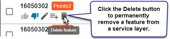
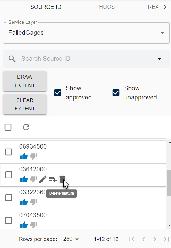
Delete permanently removes a feature from your service layer. To delete a single feature, hover the cursor over a row and click the delete button.
To delete multiple features, use the checkbox to pick the features you want to delete.
Features have two statuses: approved and unapproved. Click the thumbs up button to approve a feature. Click thumbs down button to unapprove.
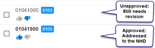
In general, approved features are addressed to the NHD, which means they have a ReachCode and Measure. However, HydroAdd does not strictly require approved features to be addressed. It is possible to approve features that have not been addressed. HydroAdd will warn you if you approve or save a feature that has not been addressed but does not disallow it.

Click the edit button to edit a feature. When you click the edit button, the editing pane opens, and the editing crosshair cursor appears on the map. NOTE: the map must be at zoom level 14 for the crosshair cursor to appear.
Learn more about editing.
Use the Edit Queue button to add or remove items from a queue.
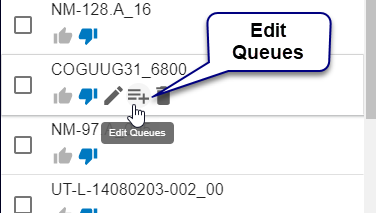
Learn more about Edit Queues.
Learn how to add or remove features from a queue.